🧊 The severe cold artic wave that has swept through the United States and Canada this week has created apocalyptic scenes, with frozen cities and lakes, and temperatures ranging between -8 and -50°C 👇
Relentless severe weather shows no mercy, ranging from intense storms and tornadoes last week to a brutal Arctic air mass 🌪️
Precipitable water and precipitation (mm/h) from Tuesday, January 9th, to Wednesday, January 10th, using the NAM model.
The convergence of a cold front and an atmospheric river, contributing a substantial amount of precipitable water, resulted in a mid-latitude cyclone that impacted the East Coast of the United States with severe storms. This led to significant rainfall accumulations, flooding, and even tornadoes from Tuesday, January 9th, to Wednesday, January 10th ⛈️
Temperature at 2 meters (°C) on Saturday, January 13th, at 6:00 UTC according to the HRRR model.
Following the storm, the Arctic cold air mass begins to descend from the jet stream in a southward undulation on Saturday, January 13th, advancing towards the central and eastern United States.
Temperatures start plummeting to -40°C 🥶📉
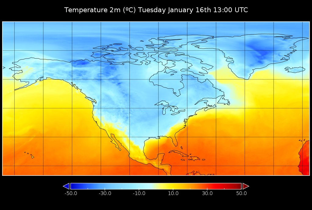
The Arctic air mass remains stationary for several days, reaching its peak in cold intensity and geographical extent on Tuesday, January 16th.
Below-freezing temperatures in the Gulf of Mexico!
Exceptionally low values are being observed in coastal areas or near the Gulf of Mexico coast. In places like New Orleans, temperatures as low as -4°C have been recorded, while Bay City, located 30km from the coast, has reported -8°C.
Accompanied by the extreme cold, heavy snowfall, and freezing rain that have heightened the hazardous conditions of the event. Freezing rain is anticipated as far south as southern Texas and Louisiana.
Is this situation normal? 📊
While such cold waves are typical in January in North America, the intensity and duration of this event have been exceptional, setting numerous records across Canada and the United States.
🌡️🏆 -51.1ºC in Keg Creek, Alberta (Canada) coldest temperature in January since 2004
The cold air advection into Chicago is exceeding the forecasts. Currently, it's approximately -23°C at O'Hare. It could drop even further. Attaining -23°C in January signifies a substantial Arctic cold. It's not too uncommon, but occurs about every 5 years.
What's next?
🥶 Another arctic air outbreak is expected to affect much of the central and eastern U.S. through this weekend. While not as severe as the previous outbreak, temperatures and wind chills are still expected to pose hazards across a significant portion of the nation.
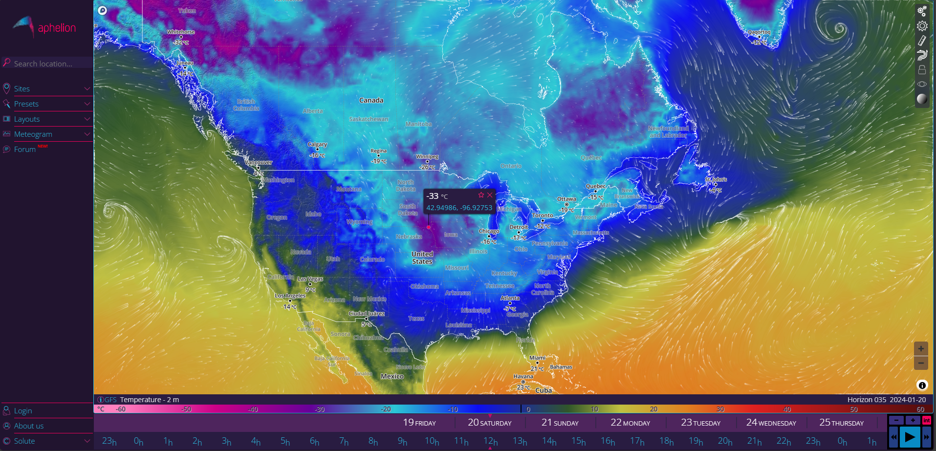
Temperature at 2 meters (°C) on Saturday, January 20th, at 12:00 UTC according to the GFS model.
Stay tuned for updates in the forecast at Aphelion Weather
And for more information on official alerts, refer to the National Weather Service